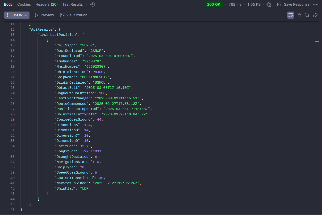
Single Vessel Last Position
Multipl Vessels Last Position
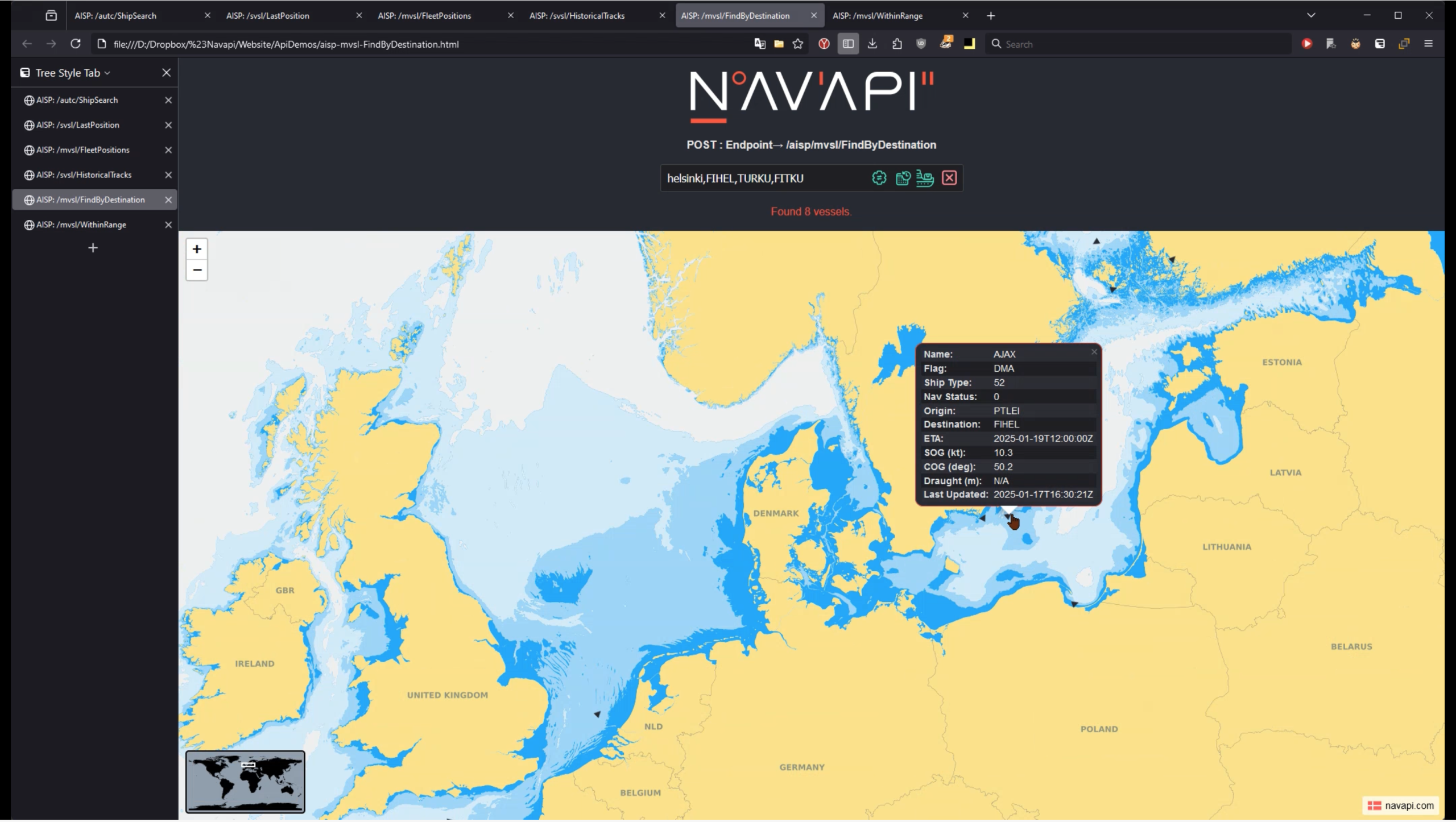
The above video is a simplified and quick demonstration, of the 6 endpoints our AIS Positions API offers, and aims to give a visual perspetive on what each of the AIS endpoints can do.
Read mote in API DocumentationThe above video is a simplified and quick demonstration, of the 6 endpoints our AIS Positions API offers, and aims to give a visual perspetive on what each of the AIS endpoints can do.
Read mote in API DocumentationThe above video is a simplified and quick demonstration, of the 6 endpoints our AIS Positions API offers, and aims to give a visual perspetive on what each of the AIS endpoints can do.
Read mote in API DocumentationThe above video is a simplified and quick demonstration, of the 6 endpoints our AIS Positions API offers, and aims to give a visual perspetive on what each of the AIS endpoints can do.
Read mote in API DocumentationThe above video is a simplified and quick demonstration, of the 6 endpoints our AIS Positions API offers, and aims to give a visual perspetive on what each of the AIS endpoints can do.
Read mote in API DocumentationThe above video is a simplified and quick demonstration, of the 6 endpoints our AIS Positions API offers, and aims to give a visual perspetive on what each of the AIS endpoints can do.
Read mote in API DocumentationThe above video is a simplified and quick demonstration, of the 6 endpoints our AIS Positions API offers, and aims to give a visual perspetive on what each of the AIS endpoints can do.
Read mote in API Documentation